Location Equipment

Underground Magnetics locating equipment is built to make HDD guidance straightforward on site—centred around the Mag X Series locating systems, designed for fast, accurate tracking of the downhole transmitter while you drill. Their software and connectivity features lean into practical job reporting: pair your locator to an Android device via Bluetooth, log bore data, and generate/share PDF reports, with optional GPS data that can be displayed on Google Maps. It’s backed up with experienced HDD support available 7 days a week, plus a loaner program to keep you working if a system needs repairs or adjustments.

Mag X PRO System

The Mag X Pro is the most powerful HDD Locating System to date. Paired with the New Echo 75XF and even the toughest jobs will be done with ease.

Core Features
  • New Solid Core 3D Antenna Cluster
    • Extended Range for the Sub-kHz Frequencies
  • Built-in Data Logging
    • Simplified one-touch logging integrated into the remote drill display
    • Rodwise and chart views with the ability to edit and add utility crossings
    • Easily emailed directly from the display and synced to the UMmaps web portal
  • Compatible with Echo 75 XF 19″ Transmitter 3 Power Levels
  • Low: 114 Feet / 100 Hours
  • Medium: 180 Feet / 60 Hours
  • High: 278 Feet / 11 Hours

Mag X GEO System

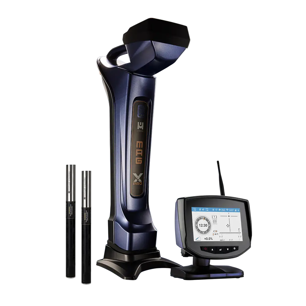
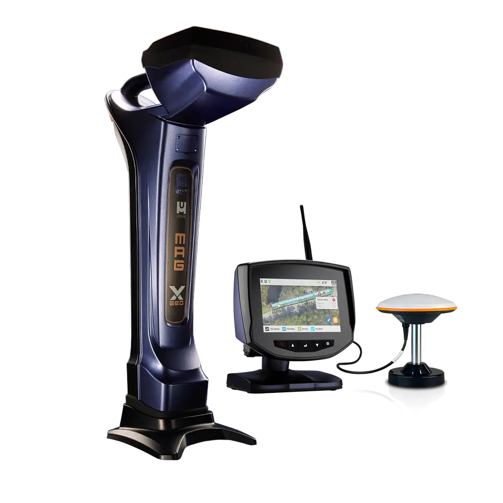
Bore Smarter, Not Harder.

The Mag X Geo builds on our trusted platform with a 7-inch color touchscreen that delivers clear, at-a-glance data. Tactile, multi-function buttons provide intuitive access to key features through fly-up menus.

Log each rod’s pitch, depth, and GPS data while marking utilities as you expose them.

View progress in real time with Chart, Map, and Rod Table views to stay on target and reduce post-job cleanup.

Guide every move with tools like Dropline and Pitch Guide for GPS-directed path and depth control, or engage Bore-To for projected depth and target alignment.

Boost accuracy and efficiency with one easy-to-use locating system built for real jobsite demands.

Precision GPS Data Logging

» RTK-Enabled GPS with 1–3 cm Accuracy
» GPS Tracking including Elevation
» Automatically Record Rod-by-Rod Metrics

On-the-Fly Functionality

» Views: Overhead Aerial, Side Profile Chart, Rod Table
» Tools: Bore-To Steering, GPS Dropline, Pitch Guide
» Logging: Rod Pitch, Roll, Temp, Depth, and GPS Data

Reporting Redefined

» Add Utility Crossings with Type, GPS, and Depth
» Generate, Share, and Sync Reports from Receiver
» Real-time Project Monitoring

UM Dual + 10w Utility Locating System

Introducing the UM Dual + 10w Locating System, the perfect tool for contract locators who need a balance of simplicity and precision. Designed for efficiency and reliability, this underground utility locator provides contractors with a powerful alternative that ensures improved accuracy, allowing locators to do more in less time.

With the Dual + 10w package, contract locators can confidently locate underground utilities with minimal training, making it the go-to tool for high-demand projects requiring accuracy and speed.